

geomatix.net
Geomatix: Providing Professional Tidal Prediction Services to the Maritime IndustryHarmonic tidal analysis, tidal surge prediction and specialist marine mapping from Geomatix.
http://www.geomatix.net/
Harmonic tidal analysis, tidal surge prediction and specialist marine mapping from Geomatix.
http://www.geomatix.net/
TODAY'S RATING
>1,000,000
Date Range
HIGHEST TRAFFIC ON
Friday

LOAD TIME
0.6 seconds
16x16
Geomatix
Stephen TAYLOR
Sto●●●lea
Nort●●●●reet
Barrow●●●●●●Humber , DN19 7AP
GB
View this contact
Geomatix
Stephen
Sto●●●lea
Nort●●●●reet
Barrow●●●●●●Humber , DN19 7AP
GB
View this contact
Webfusion Limited
Webfusion Limited
5 Roun●●●●●●Avenue
Stoc●●●●Park , Uxbridge, UB11 1FF
GB
View this contact
BUY YOUR DOMAIN
20
YEARS
9
MONTHS
0
DAYS

WEBFUSION LTD.
WHOIS : whois.123-reg.co.uk
REFERRED : http://www.123-reg.co.uk
PAGES IN
THIS WEBSITE
20
SSL
EXTERNAL LINKS
3
SITE IP
164.132.53.83
LOAD TIME
0.587 sec
SCORE
6.2
Geomatix: Providing Professional Tidal Prediction Services to the Maritime Industry | geomatix.net Reviews
https://geomatix.net
Harmonic tidal analysis, tidal surge prediction and specialist marine mapping from Geomatix.
 geomatix.net
Tidal Displays & Monitors
http://geomatix.net/tides/displays.htm
Harmonic Analysis & Prediction. Tidal Displays & Data Storage. Sea Defences & Flooding. The display module of TideSock continuously displays tidal data from any industry standard tide gauge over a LAN network. This module is incorporated as standard within TideSock enables the user to configure:-. Font: face, size, style, foreground colour, background colour. Value: numerical format string*. Variables can be displayed according to the following paramaters. Tidal Rate of Rise.
DatumPro Specification
http://geomatix.net/datumpro/spec.htm
Harmonic Analysis & Prediction. Tidal Displays & Data Storage. Sea Defences & Flooding. Over 700 Datum Conversions and their inverses. Displayed for each transformation where available. Displayed for each transformation. Displayed for each transformation. 7 Parameter matrix method for geographical transformation and polynomials. User specified as combinations of some or all of d m s or automatic (wildcards). Fields Used - degree, degrees minutes, or degrees minutes and seconds. TM, UTM, Gauss Kruger.
Tidal Analysis, Tidal Surge Prediction and Mapping from Geomatix
http://geomatix.net/index.html
Harmonic Analysis & Prediction. Tidal Displays & Data Storage. Sea Defences & Flooding. Tidal Harmonic Analysis & Prediction. Tide-Gauge Displays & Data Logging. Accurate hydrography is important. Not only for the safety of navigation, but also for the design of sea defences, tidal power schemes, in flood risk analysis, in vessel manoeuvring, in vessel passage planning, and in defining a vertical datum. We also provide in-house hydrographic and tidal services. More.
Geomatix: DatumPro ScreenShots
http://geomatix.net/datumpro/shot1.htm
Harmonic Analysis & Prediction. Tidal Displays & Data Storage. Sea Defences & Flooding. Screen Shot 1 of:- 1. Details Tab showing transform, region, ellipsoid (a, 1/f, b) and the 7 Bursa-Wolf matrix parameters.
Geomatix: DatumPro - List of Datums
http://geomatix.net/datumpro/datums.htm
Harmonic Analysis & Prediction. Tidal Displays & Data Storage. Sea Defences & Flooding. Below is a list of datum conversions supplied with DatumPro. Click for alternative listings by grid. Abidjan 1987-1 to WGS84. Adindan ADI-A to WGS84. Adindan ADI-B to WGS84. Adindan ADI-C to WGS84. Adindan ADI-D to WGS84. Adindan ADI-E to WGS84. Adindan ADI-F to WGS84. Adindan ADI-M to WGS84. Ain el Abd-1 to WGS84. Ain el Abd-2 to WGS84. American Samoa 1962 to WGS84. Ammassalik 1958-1 to WGS84. Antigua 1943-1 to WGS84.
TOTAL PAGES IN THIS WEBSITE
20
Geomatix-International | Nous ne sommes satisfaits
Skip to navigation (Press Enter). Skip to main content (Press Enter). Nous ne sommes satisfaits. Que lorsque vous l'êtes également. 216 71 23 32 57. Nos services en Géomatique. Systèmes d'information géographique. Développer des solutions novatrices et performantes dans le domaine des systèmes d'information géographique,. Réalisation et support de solutions logicielles de pointe appliquées au domaine de lagéomatique. Design de sites Web. Votre entreprise/organisme mérite un site Internet professio...
Geomatix
Wednesday, November 28, 2007. Posted by Samaee at 4:33 PM. Thursday, July 12, 2007. استانداردهاي سازمان نقشه برداري را اگه از طريق سايت سازمان مديريت گرفتيد كه گرفتيد. اگه نگرفتيد از مسير زير بگيريد . دو تا 7 مگابايتي داره بقيه اش 700 كيلوبايتيه. Http:/ m.samaee.googlepages.com/nccstandards. Posted by Samaee at 3:35 PM. Thursday, June 21, 2007. ولي همين كار باعث ميشه تا از قافله عقب بمونند چون نيرويي كه استخدام ميكنند چيزي به سيستم اضافه نميكند! Posted by Samaee at 12:36 PM. Thursday, April 05, 2007.
www.geomatix.co.uk is for sale!
This domain name is FOR SALE. If you have any questions or wish to make an offer on this domain name, please contact:. Webmaster @ geomatix.co.uk. Domain name, go to virtualnames.co.uk. Or start searching here:.
Default Web Site Page
If you are the owner of this website, please contact your hosting provider: webmaster@geomatix.com.au. It is possible you have reached this page because:. The IP address has changed. The IP address for this domain may have changed recently. Check your DNS settings to verify that the domain is set up correctly. It may take 8-24 hours for DNS changes to propagate. It may be possible to restore access to this site by following these instructions. For clearing your dns cache.
Sklep geodezyjny Geomatix - tachimetry, GPS, niwelatory, sprzęt geodezyjny, akcesoria pomiarowe
Nasz asortyment obejmuje instrumenty, przyrządy i akcesoria geodezyjne i pomiarowe:. Tachimetry elektroniczne: klasyczne i bezlustrowe, total station. Tachimetry SOUTH. Geodezyjne odbiorniki GPS GNSS do pomiarów RTK. Rozwiązania GIS, kontrolery. GPS GNSS SOUTH. Teodolity optyczne: elektroniczne i laserowe. Teodolity SOUTH. Cyfrowe niwelatory optyczne (kodowe, elektroniczne) marki SOUTH. Niwelatory laserowe, lasery budowlane punktowe, liniowe, krzyżowe, lasery rotacyjne marek Laserliner i SOUTH. A to za s...
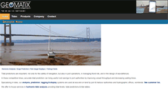
Geomatix: Providing Professional Tidal Prediction Services to the Maritime Industry
Tidal predictions are important: not only for the safety of navigation, but also in port operations, in managing flood risk, and in the design of sea-defences. In these competitive times, accurate tidal prediction can bring useful cost savings to port authorities by improving vessel throughput and decreasing waiting times. Specializing in tides, our analysis, prediction. Systems are used at sea and on land by port and harbour authorities and hydrographic offices, worldwide. See customer list.
Geomatix Group - Geomatix Group GNSS for Survey and Mapping
Geomatix Group GNSS for Survey and Mapping. Trimble Leap GNSS Receiver. Accuracy Simplified. The Trimble Leap GNSS Receiver pairs with a mobile device to collect high-accuracy data in the field. Achieve sub-meter accuracy in real time with Trimble ViewPoint RTX correction service. Collect markers, tracks, and photos in the field. Achieve full accuracy in less than 5 minutes. Export GNSS data in common formats. No base station required. Please Contact Me About Purchasing a LEAP.
geomatixpectations.com
Welcome to Geomati x. 2012 geomatixpectations.com. All Rights Reseved.
Geophysics Matlab
28 Aralık 2011 Çarşamba. LU decomposition with Python. Is an object-oriented programming language, and it's a good alternative to Matlab for scientific computing with numpy. Modules (very easy to install). Pyhton has some advanteges over Matlab for example indices start from zero, it's free and has clean syntax .We've already had the Matlab code for LU decomposition what about implementation for Python? Same fashion as in Matlab L and U matrices will kepted in A. From numpy import *. A[i,k]=A[i,k]/A[k,k].
Home: Laboratory of Geodesy & Geomatics Engineering
Laboratory of Geodesy and Geomatics Engineering. Sensor Locations Operated by GeoMatLab. The sensor locations operated by the Laboratory are available on the following map. View GeoMatLab Sensor Sites. In a larger map. Launch of new Website. New VLF and LF station for earthquake research. New EGNOS site in Crete. First Chinese BeiDou Satellite Receiver in Crete (copy 2). Regional Outreach Workshop, 1 July 2011. 2011, Deformation Monitoring and Satellite Altimetry workshop, 20-21 January, 2011.