

gis.co.crook.or.us
Crook County GISCrook County GIS
http://gis.co.crook.or.us/
Crook County GIS
http://gis.co.crook.or.us/
TODAY'S RATING
>1,000,000
Date Range
HIGHEST TRAFFIC ON
Tuesday
LOAD TIME
0.5 seconds
16x16
32x32
64x64

128x128

160x160

192x192
PAGES IN
THIS WEBSITE
10
SSL
EXTERNAL LINKS
32
SITE IP
198.163.255.39
LOAD TIME
0.494 sec
SCORE
6.2
Crook County GIS | gis.co.crook.or.us Reviews
https://gis.co.crook.or.us
Crook County GIS
 gis.co.crook.or.us
Survey disclaimer
http://gis.co.crook.or.us/Surveydisclaimer/tabid/1708/Default.aspx
Official Website of Crook County, Oregon. Disclaimer - Please read, then click "I AGREE". This product is reproduced from geospatial information prepared by the Crook County GIS Department. 2) Terms of License:. Grants the user a non-exclusive, non-sub-licensable, license to use. Digital data. This license agreement applies to all digital data acquired from. Staff, Web sites, FTP sites, or other internet-based delivery systems. In the event that another license agreement issued by. 4) No County Liability:.
Crook County Road Atlas
http://gis.co.crook.or.us/CrookCountyRoadAtlas/tabid/2409/Default.aspx
Official GIS Website of Crook County, Oregon. Crook County, Oregon. Crook County Road Atlas. Your browser does not support inline frames.
Crook County GIS
http://gis.co.crook.or.us/Home/tabid/1560/Default.aspx
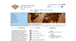
Official GIS Website of Crook County, Oregon. Crook County, Oregon. 422 NW Beaver St. Prineville, OR 97754. Phone - (541) 416-3930. Email - Contact us. Crook County GIS Department. Crook County - GIS Background . GIS and Mapping . E-Services. Survey and Plat Search. Crook County Online Map. GIS Maps and Data. More Information about the GIS Budget and projects . details. The County Court Approved Fees . details. Access FREE GIS data and metadata from the FTP site and via web services . details.
Crook County GIS > Coordinate System
http://gis.co.crook.or.us/CoordinateSystem/tabid/2303/Default.aspx
Official GIS Website of Crook County, Oregon. Crook County, Oregon. Crook County - Coordinate System. EPSG No. 2914. Spatial reference Link . Geographic coordinate reference GCS North American 1983 HARN. Projection NAD 1983 HARN StatePlane Oregon South FIPS 3602 Feet Intl. XY tolerance 0.0032808398950131233. Z tolerance 0.001. M tolerance 0.001. Latest well-known identifier 2914. Well-known text PROJCS["NAD 1983 HARN StatePlane Oregon South FIPS 3602 Feet Intl",GEOGCS["GCS North American 1983 HARN",DATUM...
Crook County GIS
http://gis.co.crook.or.us/DisclaimerPublic/tabid/74/Default.aspx
Official GIS Website of Crook County, Oregon. Crook County, Oregon. 422 NW Beaver St. Prineville, OR 97754. Phone - (541) 416-3930. Email - Contact us. Crook County GIS Department. Crook County - GIS Background . GIS and Mapping . E-Services. Survey and Plat Search. Crook County Online Map. GIS Maps and Data. More Information about the GIS Budget and projects . details. The County Court Approved Fees . details. Access FREE GIS data and metadata from the FTP site and via web services . details.
TOTAL PAGES IN THIS WEBSITE
10
Communicable Diseases
http://www.co.crook.or.us/Departments/HealthDepartment/PublicHealthServices/HealthServicesHome/CommunicableDiseases/tabid/2207/Default.aspx
Official Website of Crook County, Oregon. Birth and Death Certificates. Birth and Death Certificates. Map and Property Research. Search Surveys and Plats. Adult Parole and Probation. Special Health Care Needs. Health Services - Communicable Diseases. Sexually Transmitted Diseases (STDs). We work to prevent the spread of disease in our county by:. Providing you with information on how diseases are spread to enable you to keep yourself and others healthy. Promoting and providing immunizations. Tracking loc...
Meetings | City of Prineville
http://www.cityofprineville.com/meetings/index.php
Skip to main content. History - Bowman Museum. St Vincent De Paul. Parks and Trails Directory. Crook County School District. Powell Butte Charter School. High Desert Christian Academy. Crook County Sheriff's Office. Crook County Fire and Rescue. Economic Development of Central Oregon (EDCO). Submit a Request or Concern. Submit a Request or Concern. City Council - Special Session. City - County Joint Workshop - Tom McCall Intersection. Site Design by Aha Consulting.
Crook County > Jobs
http://www.co.crook.or.us/Departments/HR/EmploymentOpportunities/tabid/2007/Default.aspx
Official Website of Crook County, Oregon. Birth and Death Certificates. Birth and Death Certificates. Map and Property Research. Search Surveys and Plats. Adult Parole and Probation. County Policies - Employee Handbook. Crook County - Jobs and Employment. Crook County is pleased to announce that we have moved to a web-based online application system!
Crook County > RFP
http://www.co.crook.or.us/Departments/Administration/BidInformation/tabid/2000/Default.aspx
Official Website of Crook County, Oregon. Birth and Death Certificates. Birth and Death Certificates. Map and Property Research. Search Surveys and Plats. Adult Parole and Probation. County Court Agenda and Packet. County Court Meeting Schedule. Crook County - Invitation To Bid. CROOK COUNTY, OREGON -. INVITATION TO SUBMIT BID PROPOSALS. Sale and Delivery of Unleaded Fuel. To the Crook County Landfill. Sealed bids will be received until Thursday, July 28, 2016 at 2:00 pm. August 3, 2016. Complete bidding...
Home Page | City of Prineville
http://www.cityofprineville.com/index.php
Skip to main content. History - Bowman Museum. St Vincent De Paul. Parks and Trails Directory. Crook County School District. Powell Butte Charter School. High Desert Christian Academy. Crook County Sheriff's Office. Crook County Fire and Rescue. Economic Development of Central Oregon (EDCO). Submit a Request or Concern. Submit a Request or Concern. Public Notice - Council Workshop 8-23-16. City considers purchasing 460 acres from Brooks Resources. 2016 Grind and Inlay Project - August 8th.
Crook County Home
http://co.crook.or.us/Departments/Building/tabid/66/Default.aspx
Official Website of Crook County, Oregon. Birth and Death Certificates. Birth and Death Certificates. Map and Property Research. Search Surveys and Plats. Adult Parole and Probation. Welcome to the Official Government Website for Crook County, Oregon. More information about the County . details. Located in the geographic center of Oregon, where forestry and agriculture meet technology in this largely rural community: Photo Credit: Gary Halvorson, Oregon State Archives. Tr td class=ThemeCustom1 Eventtoolt...
Crook County Election Information
http://www.co.crook.or.us/Departments/Clerk/ElectionInformation/ElectionInformation/tabid/2275/Default.aspx
Official Website of Crook County, Oregon. Birth and Death Certificates. Birth and Death Certificates. Map and Property Research. Search Surveys and Plats. Adult Parole and Probation. Below are more useful links in regards to election information. Oregon Government Ethical Commission. Loading. /div '; dnn.xmlhttp.doCallBack('FAQs dnn ctr5622 FAQs',474,GetFaqAnswerSuccess,'dnn ctr5622 FAQs lstFAQs ctl00 A2',GetFaqAnswerError,null,null,null,0); } else { label.innerHTML = ' ; }".
TOTAL LINKS TO THIS WEBSITE
32
Burleigh County, ND: Apple Creek Flood & Elevation Tool
Select Apple Creek Flood Stage. Flood stages are only available for Apple Creek from I-94 to 2 miles. Downstream of Hwy 1804. The flood stages only include flood levels. From Apple Creek. Hay Creek flood levels may be higher at times. Burleigh County, ND: Apple Creek Flood and Elevation Tool. This tool is intended to help residents in flood planning along Apple Creek. Elevations throughout Burleigh County can also be found. Burleigh County, ND: Apple Creek Flood and Elevation Tool.
Under Construction
The site you are trying to view does not currently have a default page. It may be in the process of being upgraded and configured. Please try this site again later. If you still experience the problem, try contacting the Web site administrator. If you are the Web site administrator and feel you have received this message in error, please see Enabling and Disabling Dynamic Content in IIS Help. To access IIS Help. And then click Run. Text box, type inetmgr. Menu, click Help Topics.
IIS Windows Server
IIS7
Clay County GIS
Clay County, Minnesota, operates a Geographic Information System (GIS) to provide current and accurate geo-spatial (map) information to County departments, other agencies, and the general public. Clay County Official Web Site.
Crook County GIS
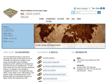
Official GIS Website of Crook County, Oregon. Crook County, Oregon. 422 NW Beaver St. Prineville, OR 97754. Phone - (541) 416-3930. Email - Contact us. Crook County GIS Department. Crook County - GIS Background. GIS and Mapping - E-Services. Crook County Online Map. Survey and Plat Search. Surveyed and Restored Corners Search. Crook County Open Data Site. The County Court Approved Fees . details. Access FREE GIS data and metadata from the FTP site and via web services . details.
Enterprise GIS Curry County Oregon Internal
City of Gold Beach. City of Port Orford. South Coast Watershed Council. Harbor Rual Fire District. Curry Wildfire Preparation Team. Curry County Interactive Map for the State of Oregon Login.
IIS7
Douglas County Property Information
Welcome to the Douglas County, Georgia Property Information website! This site allows you to search and view property tax and assessment information. As well as a variety of related maps. User acknowledges that Douglas County makes no warranties with respect to the accuracy. I Agree - Launch Website. System Requirements: IE 7.0 or Firefox 3.0.6, Adobe Reader 9.0. Screen Resolution: Minimum 1024x768. Douglas County, Georgia Government Website 2009.
FNSB | Geographical Information System
New GIS Web Site is live. It can be found at http:/ fnsb.us/gis. Welcome to the Fairbanks North Star Borough's Geographical Information System (GIS). We hope you find our GIS to be a valuable resource. Your browser must allow cookies for this site to operate properly. 8211; a list of updates and revisions. If this is your first time here, you might find the Quick Start. Comprehensive Help documentation is available. To view the Help once you are in the GIS system, click the yellow question mark. Parcel v...
SOCIAL ENGAGEMENT